Sentiero Italia SI300

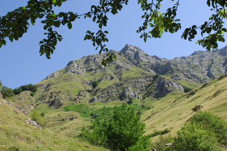
La visita del vasto territorio amatriciano offre un paesaggio boschivo e magnifici scorci naturalistici del Parco lungo la Strada Provinciale Saletta-Retrosi e la strada per Campotosto. Il vasto numero di frazioni offre ovunque tracce di antichi portali e paesini immersi nella quiete dei Monti della Laga.
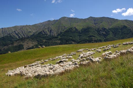
Dall’altra riva del Tronto, seguendo a tratti il tracciato della vecchia Via Salaria, sono poste altre frazioni da dove è possibile ammirare uno scorcio del lago Scandarello e una veduta d’insieme dei Monti della Laga.
– Escursione storico-paesaggistica Eremo della S.S. Croce – Lago Scandarello – Lungo l’antico sentiero della strada “Romanella”, che si imbocca nei pressi dell’Ospedale Grifoni, si giunge presso l’antico eremo, dove dall’alto si può ammirare un meraviglioso paesaggio di Amatrice. Il sentiero ridiscende poi in direzione del Lago Scandarello dove si può compiere una passeggiata lungo le rive.

“SENTIERO ITALIA SI300”
Di particolare interesse è il Sentiero Italia, un lungo sentiero di oltre 4000 km che, con 350 tappe, si snoda sull’arco alpino e sull’appennino includendo anche Sicilia e Sardegna. Lungo il tracciato, da Santa Teresa di Gallura a Trieste un unico segnavia di vernice accompagna gli escursionisti, con l’importante compito di armonizzare la segnaletica su base nazionale e rendere più sicura la percorrenza delle montagne.
A piedi per conoscere e tutelare è l’invito rivolto a chi frequenta la montagna per il rispetto dell’ambiente in ogni aspetto.
Molte le soddisfazioni: il salutare e ritmico movimento lungo i sentieri, l’attraversamento di luoghi integri, lo sguardo sulle imponenti pareti, gli incontri floro-faunistici, i piccoli paesi; tutti elementi che sottolineano forza e interesse dell’ambiente montano e delle aree protette.
Il tracciato viene segnalato con le bandierine di vernice “rosso-bianco-rosso”, ai bivi sono posizionate le tabelle direzionali in legno con informazioni essenziali per l’escursionista e nei posti tappa si trovano i tabelloni esplicativi e riepilogativi.
Il messaggio complessivo che ne deriva è di fruibilità della montagna, ma con attenzione alla conoscenza del territorio e al rispetto ambientale.
Il tratto di competenza del Sentiero Italia SI300 è curato dalla Sezione CAI di Amatrice.
La tappa SI300 è quella che interessa il territorio di Amatrice, con alcune varianti:
Amatrice, Fiume Tronto, Retrosi, Icona Passatora, S. Martino, Fosso di Selva Grande, Sacro Cuore, Capricchia, Icona Passatora, Retrosi, Amatrice
Oppure seguendo in parte il sentiero sopra citato, in corrispondenza del Sacro Cuore si continua per: Preta, Pozze Testa, Campotosto.
Amatrice, Madonna di Filetta, S. Lorenzo a Flaviano, Collalto, Accumoli, Forca Canapine
Amatrice, Fiume Tronto, Retrosi, Icona Passatora, Capricchia, Sacro Cuore

A visit to the vast territory of Amatrice offers a wooded landscape and magnificent naturalistic views of the Park along the Saletta-Retrosi Provincial Road and the road towards Campotosto. The vast number of hamlets in the area provide numerous traces of ancient portals and the presence of small towns immersed in the quiet of the Laga Mountains.
On the other side of the Tronto river, roughly following the course of the old via Salaria, there are other hamlets where you can admire a view of Scandarello lake and an overall view of the Laga Mountains.
– Historic-scenic excursion Eremo della S.S. Croce (Hermitage of the Holy Cross) – Scandarello Lake – along the ancient path of the Romanella road, which you pick up near the Grifoni hospital, you arrive near the ancient hermitage, from which you can admire the marvelous scenery of Amatrice from above. The path then goes back down towards Scandarello lake where you can walk along the lake’s shores.
SENTIERO ITALIA SI300
The Sentiero Italia national trail is particularly interesting. This is a trail over 4,000 km long, with 350 stops, which winds along the Alpine Arc and the Apennines, and continues through Sicily and Sardinia. Along the trail, from Santa Teresa di Gallura all the way to Trieste, a single type of trail marking accompanies hikers, thus carrying out the important task of unifying the markings at the national level and making travel in the mountains safer.
“On foot to learn and protect” is the invitation addressed to those who go to the mountains, to respect every aspect of the environment.
There are many satisfactions to be found here: the healthy and rhythmic movement of walking along the paths, passing through unspoiled areas, gazing at imposing mountain walls, encounters with flora and fauna, and the small towns; these are all elements that emphasize the strength and interest of the mountain environment and the protected areas.
The trail is marked with small painted “red-white-red” flags; at the forks in the road, there are wooden directional signs with essential information for hikers, and in the stopping areas there are boards which explain and summarize the characteristics of the trail.
The overall result is a message of usability of the mountains, but with care for learning about the land and respecting the environment.
The section pertaining to the Italy Path SI300 is managed by CAI section of Amatrice.
The SI300 portion of the trail includes the territory of Amatrice, with certain alternative routes:
Amatrice, Fiume Tronto, Retrosi, Icona Passatora, S. Martino, Fosso di Selva Grande, Sacro Cuore, Capricchia, Icona Passatora, Retrosi, Amatrice
Or partially following the trail indicated above, at the height of Sacro Cuore, you continue towards: Preta, Pozze Testa, Campotosto.
Amatrice, Madonna di Filetta, S. Lorenzo a Flaviano, Collalto, Accumoli, Forca Canapine


